
This post is also available in: Englisch
Many people are interested to know what the “tallest mountain in the world” is. Those who assume this would be Mt Everest want to know the height of Mount Everest. The answer seems to be easy, but a closer look reveals the complexity of this questions.
How tall is Mount Everest?
The easy version first:
How tall is Mount Everest in km? 8,848 meters
How tall is Mount Everest in feet? 29,029 feet
How tall is Mount Everest in miles? 5 miles and 876 yards
The Earthquake changed the height of Mt Everest
The recent earthquake in Nepal did change the height of Mount Everest and most likely also its location.
Scientists estimate that the Summit of Mt Everest “may have shifted by a few centimeters (less than 10 centimeters) both vertically and horizontally”. But they are not even sure whether its height increased or decreased.


Obviously it is difficult to determine its exact position. Today, satellite images are evaluated and other methods are used.
A while ago, state-of-the-art technology was carried up to the top of the world. Cartographers determined the height of Mt Everest to be
- 8,850 meters
- 29,035 feet
- 5 miles and 878 yards
In fact, this does not really matter, because the worlds tallest mountain is still growing.
The tectonic plate of India presses forward; the Indian subcontinent has penetrated more than 1,200 miles (1,900 kilometers) beneath the Eurasia tectonic plate. As India pushes, Mt Everest continues to rise.
So far, we do not know exactly at which rate Mount Everest raises and whether and when it will hit 9,000 meters.
The tallest Mountain in the world
What is the tallest mountain in the world?
Mt Everest is the tallest mountain in the world!
How can we be so sure?
Hawaiian Islands
Many people think “Mount Mauna Kea”, the volcano on the Hawaiian Islands is he highest mountain on earth.
Mauna Kea has an altitude of 4,205 meters (13,796 feet) above sea level – much lower than Mt Everest. However, Mauna Kea is a Hawaiian island and if the distance from the bottom of the nearby Pacific Ocean floor to the peak of the island is measured, then Mauna Kea is „taller“ than Mount Everest.
As we will see shortly, this definition is fine. If you like to believe it, do so.
Officially however, this statement has a couple of flaws.
Firstly, why should a mountain be above sea level?
Secondly, what is the “bottom of a mountain”?
Is the highest mountain in the world under water?
Submarine volcanoes or seamounts, if inactive, could also be considered.
A huge “island” volcanoes, like the Hawaiian island mountain Mauna Kea has been recently identified under the Pacific Ocean. Scientists claim that “Tamu Massif, about 1,000 miles (1,600 kilometers) east of Japan” is the biggest volcano on Earth and one of the biggest in the solar system.
“The giant shield volcano is in the same league as Olympus Mons on Mars, which had been considered to be the largest volcano in the solar system.”
It is likely, that there is a mountain under water, which is higher than Mt Everest or Mt Mauna Kea by above definition.
Topography of the tallest mountain in the world
“Topography is a field of geoscience and planetary science comprising the study of surface shape and features of the Earth and other observable astronomical objects including planets, moons, and asteroids.“
And Topography provides to definitions that help to understand why Mt Everest is the highest mountain in the world.
Topographic Prominence
Wikipedia claims that in topography, “prominence characterizes the height of a mountain’s or hill’s summit by the vertical distance between it and the lowest contour line encircling it and no higher summit. It is a measure of the independence of a summit.”
Suppose that the sea level rises to the lowest level at which the peak becomes the highest point on an island. The prominence of that peak is the height of that island.

For Lhotse, the fourth highest mountain of the world, the south col of Mt Everest at around 8,000 meters is the highest contour line, representing the base for its prominence.
This means also, independent from the sea level, there will never be a taller island than the one wit Mt Everest on it.
Topography creates a whole new list of the highest mountains:
- Mt Everest, Nepal / China 8,848 meters
- Aconcagua, Argentina, 6,962 meters
- Mount McKinley (Denali), US, 6,194 meters
- Mount Kilimanjaro, Tanzania, 5,895 meters
- Pico Cristóbal Colón, Colombia, 5,700 meters
- Mount Logan, Canada, 5,959 meters
- Pico de Orizaba, Mexico, 5,636 meters
- Vinson Massif, Antarctica, 4,892 meters
- Puncak Jaya, Indonesia, 4,884 meters
- Mount Elbrus, Russia, 5,642 meters
Only one peak in Nepal? The highest summit in Europe even behind an Indonesian peak?
Topography has one more definition of what a mountain is:
Topographic Isolation
The topographic isolation of a summit is the great circle distance to the nearest point of equal elevation. Topographic isolation represents a radius of dominance in which the summit is the highest point. The list of the highest mountains by Isolation also is funny:
- Mt Everest, Nepal/China
- Aconcagua, Argentina
- Mount McKinley (Denali), US
- Kilimanjaro, Tanzania
- Puncak Jaya, Indonesia
- Vinson Massif, Antarctica
- Mont Orohena, Tahiti
- Mauna Kea, United States
- Gunnbjørn Fjeld, Greenland
- Aoraki/Mount Cook, New Zealand
Ever heard of there mountains? Well this is definitely better than prominence, because of
13. Mont Blanc, Italy/France, 4.810 m,15.781ft
Making Mont Blanc the tallest mountain in Europe!
What is the tallest mountain in America?
With topographic definitions, this answer is easy.
The Aconcagua in Argentina is the tallest mountain in America.
Mount McKinley (Denali) is the tallest mountain in North America.
To comfort those feeling sad about this statement: “The dry prominence of Mt Everest is, by convention, equal to its wet prominence (8848 m) plus the depth of the deepest hydrologic feature (the Challenger Deep at 10,911 m), or 19,761 m.
The dry prominence of Mauna Kea is equal to its wet prominence (4205 m) plus the depth of its highest col (about 5125 m), or about 9330 m; this is the world’s second greatest dry prominence after Mt Everest.”
Also, Mount McKinley is definitely one of the hardest of the high mountains to climb, because it is so cold there.
Problems with the definition of the tallest mountain
There is not only a discussion about what the tallest mountain on Earth is. It is also disputed which the subsequent mountains are.
The eight-thousanders are the highest mountains on earth. 14 great peaks:
- Mt Everest, 8848 m (29,029 ft)
- K2 Mountain, 8611 m (28,251 ft)
- Kangchenjunga, 8586 m (28,169 ft)
- Lhotse, 8516 m (27,940 ft)
- Makalu, 8485 m (27,838 ft)
- Cho Oyu, 8201 m (26,906 ft)
- Dhaulagiri I, 8167 m (26,795 ft)
- Manaslu, 8163 m (26,781 ft)
- Nanga Parbat, 8126 m (26,660 ft)
- Annapurna I, 8091 m (26,545 ft)
- Gasherbrum I (Hidden Peak), 8080 m (26,444 ft)
- Broad Peak, 8051 m (26,414 ft)
- Gasherbrum II, 8035 m (26,362 ft)
- Shishapangma, 8027 m (26,335 ft)
Eight-thousander sounds great. We do not use “Top 10” or “26.500 footers” because it does not sound that cool.
But why are there 14 eight-thousanders?
There are 20 peaks above 8.000 meters high:
- 5. Yarlung Khang -8505m (Kanchenjunga West), Nepal
- 7. Kanchenjunga South- 8476m
- 8. Kanchenjunga Central – 8473m
- 9. Lhotse Middle – 8413m
- 10. Lhotse Shar – 8400m
Leaving five of the 14 eight-thousanders out of the top 10 list. To make it 20 we add the mountain China is asking for since decades:
- 20. Broad Peak Central (Pakistan-China border).
This question has been raised again and again. Recently Nepal was demanding to define more eight-thousanders. Ang Tshering Sherpa of UIAA is asking to recognize six further peaks as eight-thousanders to make Nepal more attractive to tourists.
The reason that has not been done so far is the definition of a mountain. A prominence of 300 meters is required to make a peak a mountain:
| Term | Prominence |
| Subpeak | < 30 m |
| Independent peak or summit | 30 m or more |
| Mountain | 300 m or more |
It could be 100 meters, which would make Yalung Kang, Kangchenjunga South and Broad Peak Central eight-thousanders.
Picture: Mark Horell
See on the foto Lhotse, Lhotse Middle and Lhotse Shar: The right peak is Lhotse Shar (8386 meters high with a prominence of 86 meters), and between them Lhotse Middle (8410 meters with a prominence of 60 meters).
K2 Mountain
Dick Bass started made an own list. He defined the highest mountain on each continent as target and completed to climb all of the 1985. Reinhold Messner did not like his list of “Seven Summits” and exchanged one mountain. This did not help him – he remains second finisher of the Seven Summits.
Today there are also the second Seven Summits, the second highest peak on each continent including K2 Mountain, and the third Seven Summits.
A lot of lists.
There were many lists of mountains. Eight-thousanders, the First, Second and Third Seven Summits, the „fourteeners” or the Four-thousand footers.
One of the best-known ones gave the name for one of the most famous mountains of the world. The Great Trigonometric Survey throughout most of the 19th century defined the demarcation of the British territories in India and the measurement of the height of the Himalayan giants. The highest identified in this survey was Masherbrum.


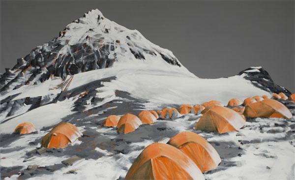
Oil Painting, Portraits and Landscape Painting
Ölgemälde, Porträt, Landschaftsbilder
100 cm * 70 cm, 2016
Karakorum 2, the second highest, is still know as the K2 mountain.
Around that time, Dhaulaghiri in Nepal was supposed to be the highest mountain on the world.
Other Top 10 Lists
There is no universally accepted definition of a mountain.
Elevation, volume, relief, steepness, spacing and continuity have been used as criteria for defining a mountain.
In the Oxford English Dictionary a mountain is defined as „a natural elevation of the earth surface rising more or less abruptly from the surrounding level and attaining an altitude which, relatively to the adjacent elevation, is impressive or notable.“
The Whittow’s Dictionary of Physical Geography states „Some authorities regard eminences above 600 m (2,000 ft) as mountains, those below being referred to as hills.“
In the United Kingdom and the Irish Republic, a mountain is usually defined as any summit at least 2,000 feet (or 610 metres) high.
The UN Environmental Programme’s definition of „mountainous environment“ is even more complicated and requires to know the elevation, the slope and the elevation range of a mountain.
My mountains
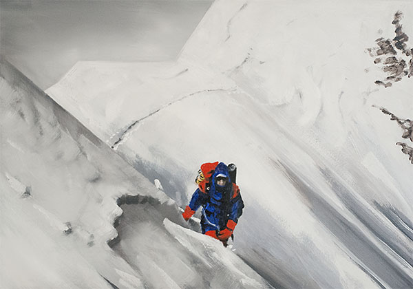
Oil Painting, Portraits and Landscape Painting
Ölgemälde, Porträt, Landschaftsbilder
100 cm * 70 cm, 2016
Links
- https://en.wikipedia.org/wiki/Mount_Everest
- http://news.nationalgeographic.com/2015/04/150428-everest-height-nepal-earthquake-geology-science/
- http://www.extremescience.com/everest.htm
- http://www.nationalgeographic.com/features/99/everest/roof.html
- http://news.nationalgeographic.com/news/2013/09/130905-tamu-massif-shatsky-rise-largest-volcano-oceanography-science/
- https://en.wikipedia.org/wiki/Topography
- https://en.wikipedia.org/wiki/Topographic_prominence
- http://gearjunkie.com/worlds-10-most-dangerous-mountains/3
